Immersive Project Showcase Recap: Exploring a Virtual Machu Picchu
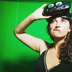
On Tuesday June 19th we held our 3rd Immersive Project Showcase. Led by Professor Takehiko Nagakura of the MIT Department of Architecture, our 15 attendees traversed the cliffs and ruins of a virtual Machu Picchu.
Professor Nagakura created his model of Machu Picchu using a technique called photogrammetry. He used drones to take many photographs around Machu Picchu and its surrounding landscape, and constructed the model from those images.
For this event, he combined two of his models together, one on top of the other. The first was a huge “mega model” of both Machu Picchu and its surrounding landscape. The second was a smaller, more detailed section that included photos taken by Hiram Bingham’s expedition team when he first arrived at Machu Picchu. These photos were geolocated throughout the model and Prof. Nagakura used them to highlight differences between the way Machu Picchu used to look and how it looks now.
By drawing on the model itself, Prof. Nagakura outlined the path a visitor would take to arrive at Machu Picchu using the large model, aka “megamodel.” This included a bus ride up a very steep, winding road. Maybe I’ll stick to virtual reproductions.
One of Professor Nagakura’s research interests is his preservation work. His work, in conjunction with the government of Peru, is allowing us to preserve, experience, and learn from historical sites in completely new ways. Using virtual reality in this way brought a group of people into a historical site, one they may not have known the history of or thought they would visit. After exploring the model in immersive VR perhaps they’ll want to visit it in real life as well!
If you’re interested in attending future Immersive Project showcases, you can sign up here!
